Chichester Harbour has a rich history of settlement and trade, dating back to the Iron Age. The Harbour is an interesting historic environment and archaeologists are still finding new areas of interest today.
A brief history of Chichester Harbour
Taken from: Chichester Harbour: A Reference Guide 2006
Modern times
Tithe maps from the early 19th century provide field names that give clues about local industrial and agricultural processes such as ‘Brick Kiln Marsh’. During the Industrial Revolution windmills and watermills sprang up as well as tidemills. Industries such as salt making continued into the late 19th century. Local clay was used to make bricks and industries such as fishing, boat building and rope making thrived.
More modern remains relate to the defence of Britain. The airfield at Thorney Island was established in 1938. During the Second World War, pill boxes and machine gun positions were built along the coast of the harbour. The harbour also played its part with distracting enemy bombers from Portsmouth, with urban lighting simulated at Itchenor and a dummy airfield complete with fake planes at West Wittering.
The post war growth in population, prosperity and leisure time hastened the evolution of the harbour as one of the most important recreational centres for water sport on the South Coast of England. The number of boats grew rapidly, moorings and marina berths multiplied and the pressure of people and development became more demanding. The Conservancy was set up in 1971 to be responsible for the management of the whole of the land and water which made the Chichester Harbour Area of Outstanding Natural Beauty (AONB).
Post Norman Invasion
Nearby Chichester developed as a major town in the 10th century. The principal landing place was Dell Quay, once the 6th most important port in England, with goods then transported by road to the town.
The Domesday survey of 1086 mentions many of the villages that exist today: Bosham, Thorney, Fishbourne, Birdham, Itchenor including details of assets such as mills, fisheries and salterns.
During Medieval Times (AD 410-1485) there was a general decline in population in the area. Bosham is an exception as it became centrally important. The village claims to be the most ancient site in Sussex with a continuous tradition of Christianity. The church was built around AD 1050-1100. The famous Bayeaux Tapestry depicts King Harold II (1066) praying at the church.
Maps provide useful evidence of how the AONB has changed in the recent past. The 1575 Saxton map shows Thorney Island detached from the mainland. The north part of the Island was reclaimed relatively recently.
Roman times
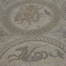
The arrival of the Romans (AD 43-410) brought major changes in social and economic conditions in England and Wales. The Palace at Fishbourne is associated with Togidubnus, a king who was an ally of Rome. It’s mosaics show it was the home of a high-status individual. As well as the Palace, the Romans built a cluster of buildings around Broadbridge Farm including a temple and possible ampitheatre. In addition they left a system of roads including the Chichester to Bitterne road which marks the northern boundary of the AONB.
During Iron Age and Roman periods, salt was collected with works found on Chidham’s west coast and at the head of the Thorney Channel.

Pre-history
The earliest humans may have arrived in Chichester Harbour during the Prehistoric Period (450,000 BC – AD 43). The Harbour would have been unrecognisable with elephants, lions and hyenas roaming freely with bears and wolves.
During the Mesolithic period (12,000 – 4,000 BC), today’s Harbour was 50km from the coast. The sea levels were much lower with much of the water locked into glaciers. Temporary camps were scattered along the deep ravines where freshwater streams ran from the Downs to the coast. This landscape changed as the glaciers melted about 8,000 years ago.
Flints that would have been vital to life during the Neolithic period (4000 – 2000 BC) can still be found today on the shoreline. With seasonal grazing, butchering and hide preparation taking place, this area was an important part of the Neolithic economy.
The first permanent settlers seem to have been established during the Bronze Age (6000 – 2000 BC). Round houses have been found on Hayling Island and pits containing domestic rubbish such as pottery hint at settlements near Bosham.
Pollen can also give clues to the past. Analysis of pollen from the Bronze Age and Iron Age (600BC – AD 43) shows that saltmarsh was developing as the sea level rose and the salt content of tidal streams and rivers increased.
The Conservancy’s role
The landscape of Chichester Harbour reflects its history. The historic environment and heritage assets of the Area of Outstanding Natural Beauty will continue to be conserved and enhanced in keeping with its inherent value, with increased opportunities to access, better understand and appreciate the past.
Find out more about what we are doing to protect the historic environment and heritage assets.
The Conservancy hosts the Chichester Harbour Heritage Partnership which meets twice a year to discuss projects and items of interest. Current projects include:
CITiZAN – a project where volunteers can record archaeological features along the shoreline.
FIPAD – a project to encourage fishermen to report archaeological finds.
If you interested in archaeology and would like to get involved with future projects, please contact the Chichester & District Archaeology Society (CDAS).